


![]()
Disaster evacuation information
Disaster evacuation information
Find your nearest designated evacuation site on an area map to ensure safety in the event of a disaster.
* Displayed information is based on the open data of the Geospatial Information Authority of Japan (under the Ministry of Land, Infrastructure, Transport and Tourism)
Find your nearest designated evacuation site on an area map to ensure safety in the event of a disaster.
* Displayed information is based on the open data of the Geospatial Information Authority of Japan (under the Ministry of Land, Infrastructure, Transport and Tourism)
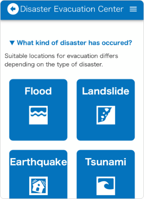
- Situations
-
- Earthquake
- Tsunami
- Flood
- Landslide
How to use
-
Select the type of disaster in question.
-
The GPS will be activated and the evacuation site nearest to your current location will be displayed on the map.
You can search with keywords such as station names, or with the exact address.Type of icon
 Current location
  Evacuation sites
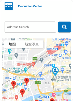
-
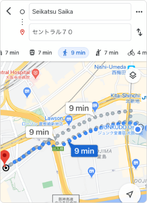
Select the evacuation site icon to display the route and travel time from your current location.
Available languages (5 foreign languages + Japanese)
English, Traditional Chinese, Simplified Chinese, Korean, Thai